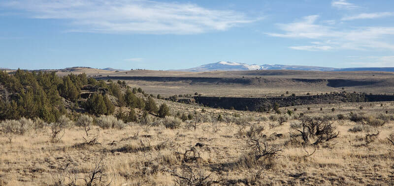
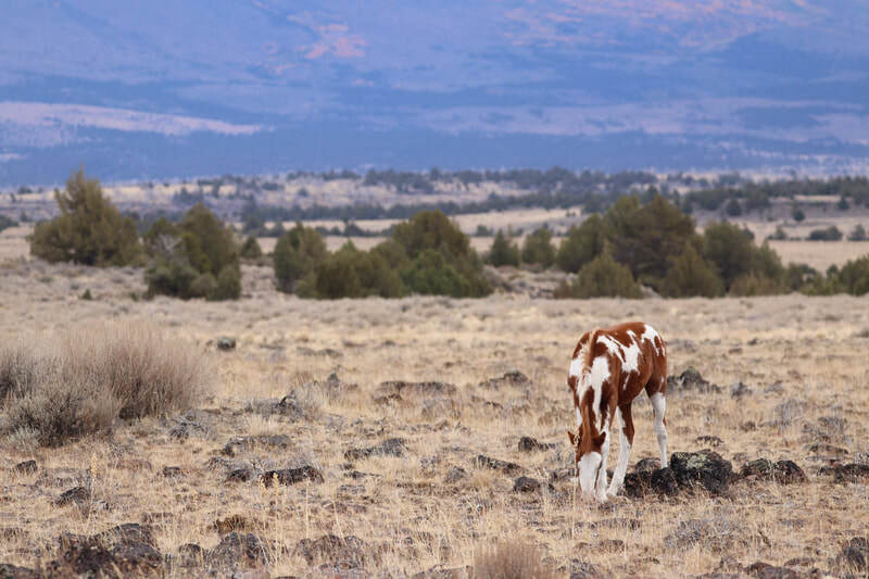
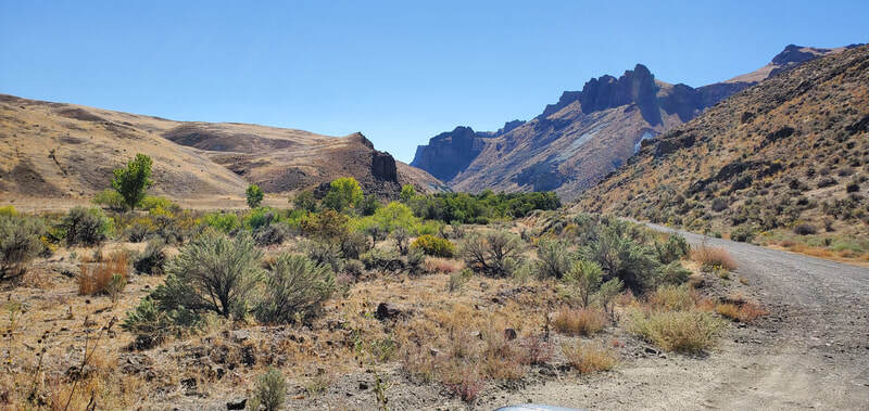
Finding Wild Horses in Oregon
Return to Finding Wild Horses here for tips on visiting the range and to find herds in other areas
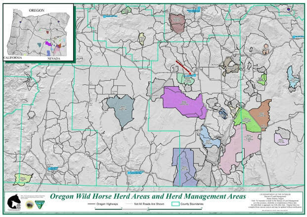
There are 19 wild horse and burro herds remaining in Oregon, 17 managed by the BLM, 1 managed by Forest Service, and 1 managed by both. There is also 1 public wild horse holding pen.
• Baron Valley Complex:
• Coyote Lake / Alvord Tule Springs west of Harper
• Sheepshead / Heath Creek northwest of Burns Junction
• Sand Springs north of Burns Junction in southern Oregon
• Beaty Butte is 65 miles of Lakeview
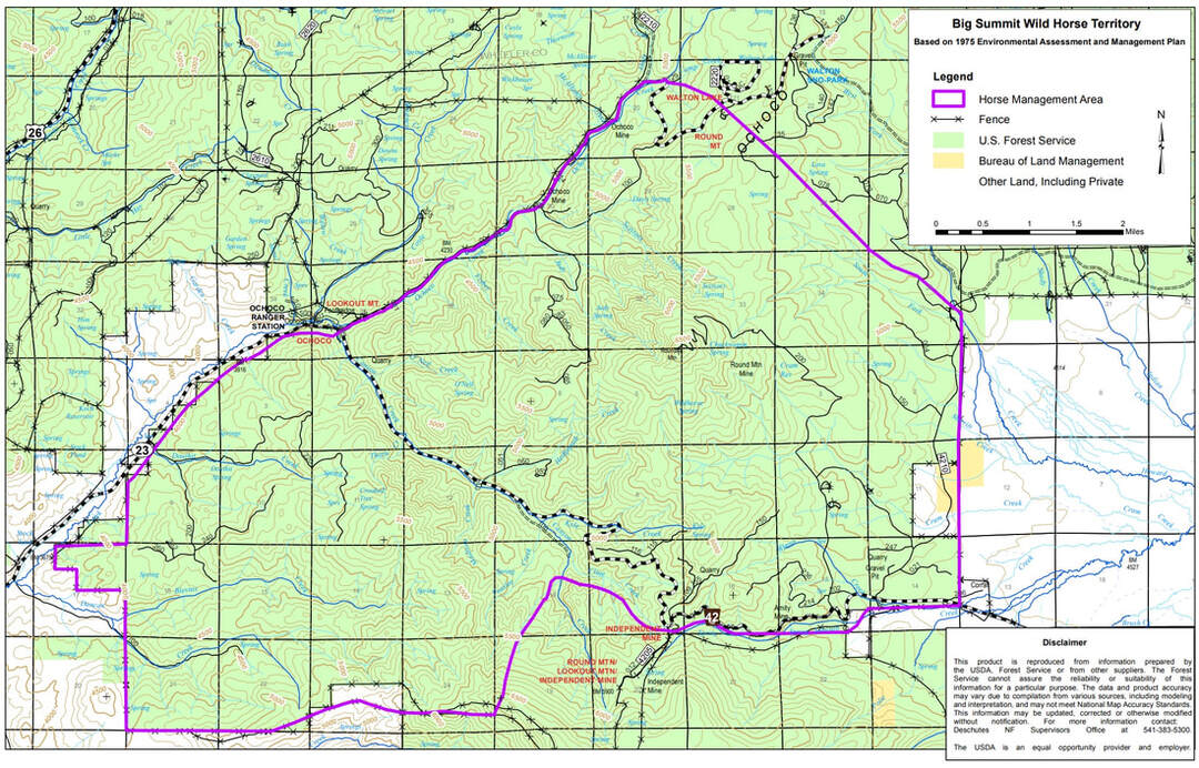
• *Big Summit Wild Horse Territory (Ochoco) is 25 miles east of Prineville
• Cold Springs is 25 miles SW of Harper
• Hog Creek between Harper and Vale
• Jackies Butte is south of Rome
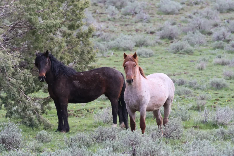
• Kiger southeast of Burns, east of Diamond
• Liggett Table is 10 miles southwest of Paulina
• Murderer's Creek southwest of John Day
• Oregon Wild Horse Corral (aka Burns Holding) just west of Hines, OR
• Paisley Desert between the towns of Paisley and Christmas Valley
• Palomino Buttes west of Burns
• Pokegama between Ashland and Klamath Falls
• Riddle Mountain southeast of Burns
• South Steens southwest of French Glen
• Stinkingwater east of Burns
• Three Fingers south of Vale close to the Idaho border
• Warm Springs southwest of Burns
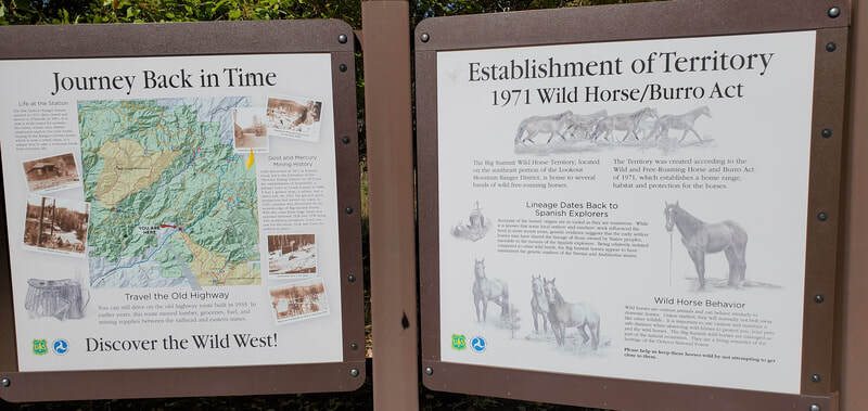
*The Big Summit / Ochoco wild horse area was subject to a wildfire in Fall of 2024. In addition, the USFS now plans to zero out that herd in favor of livestock grazing.
Size: 437,120 acres
Number of wild horses the BLM deems appropriate for the herd area is 100-250
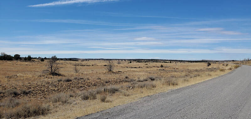
Funnel Canyon Rd / BLM Rd 6126D will T junction at BLM Rd 6126 / Long Draw Rd - turn right (west - northwest) to avoid crossing the Nevada border. The road will then split and circle Bald Mountain; you could go either way, staying to the right to again avoid heading south into Nevada. Heading north after Bald Mountain will put you on Beaty Butte Rd / BLM Rd 6176 and that will take you right up the middle of the HMA. Rd 6176 eventually does a U-turn and heads back south along the western border of the HMA and will eventually take you out to Highway 140. Go west and you will head to Lakeview.
If heading to the Beaty Butte HMA from Lakeview, do the above directions in reverse taking Hwy 140 eastbound and turning left onto Beaty Butte Rd / Rd 6176 or continuing on a few more miles and turning left (north) onto the eastern entrance to Rd 6176 / Ackley Camp Rd.
I have not been to this HMA; most of the 'roads' in the HMA appear to be two-track dirt roads so a high clearance vehicle is recommended. Because it is such a large area, keep track of your turns and the direction you are going.
Size: 25,434 acres
Number of wild horses the Forest Service deems appropriate for the herd area is 10-15
The Big Summit / Ochoco wild horse area is east of Prineville off Hwy 26. From Prineville, travel approximately 14.3 miles to Ochoco Creek Rd/Ochoco Ranger Station Rd and turn right. At the fork you can turn left onto Road 22 and search around the north side of Round Mountain. Or you can take a right on Road 42 and search around the south side of Round Mountain. You could do this as a loop; from Road 42 turn left/north onto 4210, then left again to head toward Walton Lake, and left again on Road 22. There are several gravel roads you can take while doing the loop. Watch for signs of horses in the meadows or near water sources.
I was there in the Fall and it was hunting season; while we saw signs of horses I didn't get to actually see any. I suggest visiting when it isn't hunting season and that may give you a better chance to find the horses. You could explore some additional forest roads further up Hwy 26 but once you reach the Ochoco Forest boundary you may be leaving the herd area.
The Forest Service wants to remove this herd entirely and had plans to do just that in 2022 but had to postpone. UPDATE: *The Big Summit / Ochoco wild horse area was subject to a wildfire in Fall of 2024 and we don't know the status of the population as of right now. In addition, the USFS now has definite plans to zero out that herd in favor of livestock grazing. UPDATE: some wild horses were spotted by photographers in the Spring of 2026.
Size: 29,833 acres
Number of wild horses the BLM deems appropriate for the herd area is 75-150
To get to the herd area, take Highway 20 and turn south onto Crowley Rd at the town of Harper and stay to the right. You will drive 27 miles south and when you get to that point, which should be Shumway Cutoff Rd, keep going south to enter the HMA and start looking for signs of wild horses. If there are signs of horse trails or manure you can take any smaller roads in the valleys to explore. Then keep heading south on Crowley Rd, exploring. Eventually Crowley Rd will turn west, then sharply south - at this point you should be exiting the herd area.
If you stay on Crowley Rd it will eventually lead you out to Highway 78; go north and you will head toward the town of Burns. Otherwise go back out the way you came from and head north back to Harper. This herd area is remote and you should get an early start and plan for an all day trip. I have not been to this HMA but I do suggest a high clearance, 4WD vehicle.
Size: 553,603 acres
Number of wild horses the BLM deems appropriate for the herd area is 198-390
This herd area is bordered on the north by the Sheepshead / Heath Creek HMA and is the west of Highway 78. To get here go south of the 78/95 junction approx 6.1 miles and turn west onto Tudor Rd (there may or may not be a locked gate here, if so continue south to Whitehorse Ranch Ln); or take Highway 78 north of McDermitt and turn west onto Whitehorse Ranch Ln which appears to be the south border of the herd area.
Size: 21,814 acres
Number of wild horses the BLM deems appropriate for the herd area is 30-50
At this point the road to the left (west) will follow the river but if you turn north you will be entering the herd area. There is a fence line to the east of this and it appears that there are horse trails are along it. The dirt road will head north and run into another road, go west on that one toward Brown Reservoir (which looks dried out on the map) to stay in the herd area. This road goes west -northwest and heads to Red Rock Canyon. There are a few two-tracks that head south, you can take those to look for horses. You could continue north thru Red Rock Canyon for a ways, but if you see no signs of horse piles or trails, then turn around and head back south.
The other option is to stay left at the fork on Copeland Rd from Harper and follow the river westbound; if you stay on this road it will eventually take you back onto Hwy 20. Before you reach Hwy 20 you can take any number of two-tracks that head north; I can see a few springs/water holes in the area and what appear to be horse trails.
There is a ridgeline to the west, the Hog Creek Ridge, and that is the western border of the herd area. This is a small herd area so if you cross any cattle guards with fence lines or fence gates as you go north and you see no sign of horses on the other side, then you should probably just turn around and keep searching between there and the main highway.
Size: 65,211 acres
Number of wild horses the BLM deems appropriate for the herd area is 75-150
To get to the herd area, take Skull Creek Rd south off of Highway 98 just west of Rome. After .8 mile the road will split, go right to take Indian Fort Creek Rd; you will immediately drive by a set of corrals and then go over a cattle guard. I'm not sure where the herd area starts exactly but you might start seeing signs of wild horses once you cross the cattle guard. The road forks again shortly after; if you go left you will stay on Indian Fort Creek Rd which appears to turn into Mustang Reservoir Rd. You should be able to see Mustang Butte and Grassy Mountain to the east.
The road will fork again at Squaw Flat; if you go straight/left it turns into Horse Camp Res Rd / Rd 6357 - you could go a short way on this road but if you don't see any signs of horses by the time you reach Skull Creek Rd, turn around and go back to the fork and turn south. Shortly after, turn west/right onto Skull Creek Rd and explore any suitable two-tracks or side roads searching for horses. Skull Creek Rd will cross over Beber Ranch Rd / Potomac Ranch Rd, you could turn north here or go a short distance and turn north on Butte Creek Ranch Rd / Rattlesnake Creek Rd. This will take you either west or north to Highway 95 and I believe puts you outside of the west boundary of the herd area.
I would keep the search for horses north of Skull Creek Rd and between Mustang Res Rd to the east and Rattlesnake Creek Rd to the west. If you get lost or turned around, heading west or north will lead you out to Highway 95.
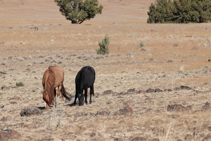
Size: 36,618 acres
Number of wild horses the BLM deems appropriate for the herd area is 51-82
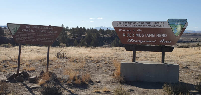

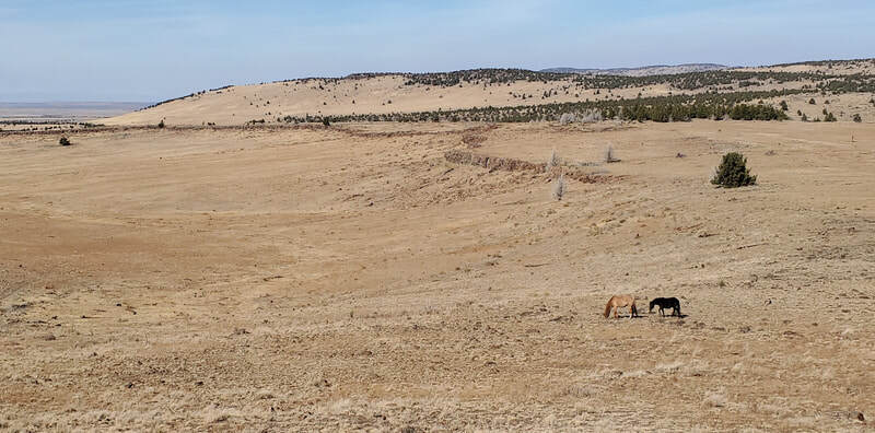
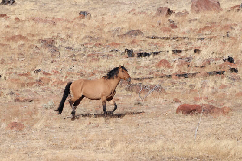
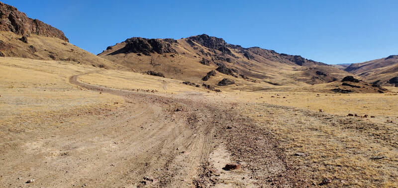
The Kiger HMA itself is easy to get to and you'll know you're there by the two signs at the beginning of the dirt road. To get to the HMA and if you stay on the main dirt road only within the herd area then most vehicles will be suitable. If you take any sides roads though there are places with rocks in the road and ruts. So to be safe I do suggest a high clearance vehicle with good tires; 4WD is not necessary.
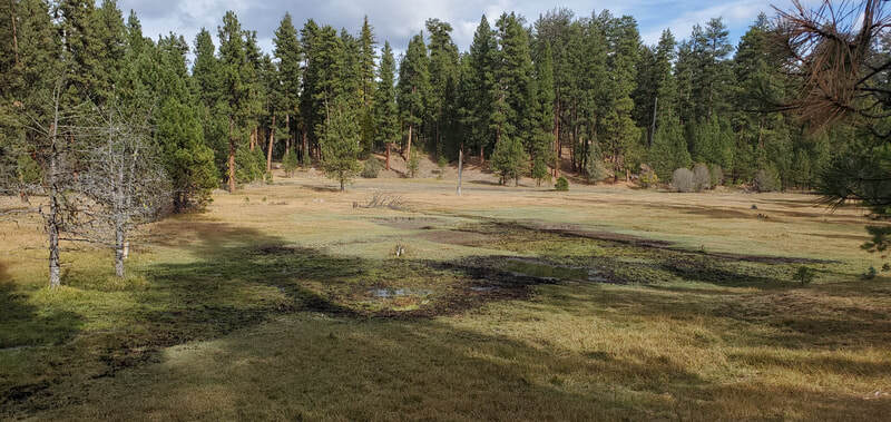
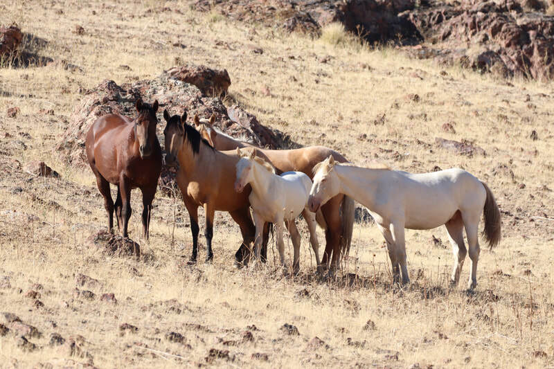
To get to the herd area, take Hwy 205 south out of Burns towards the Malheur Wildlife Refuge and turn east on Diamond Ln about 1/2 through the refuge area. Diamond Ln will end at a T junction, stay left onto the gravel road and you will soon pass a old ranch on the right and pastures likely filled with cattle. The road will then split, stay right onto Happy Valley Rd and this will take you up the side of a hill with views of the valley below on your right. Soon after, the road flattens out and you'll want to keep an eye out on the right for the herd area signs (see top left photo), turn right. This road will Y off to the right toward the 'Kiger Viewing Area' as listed on Google Maps; I did find a small herd a few miles in. There are some two tracks as well you can take. I saw more wild horses by staying to the left (east) rather than to the right (west).
You can also continue straight on the main dirt road and keep your eyes open. If you stay straight, once you pass a second cattle guard, there is a road that heads up a hill to the right. I took that road several miles in and saw signs that wild horses were present.
There are a few water holes along the dirt roads which are evident by the built up dirt berm. Some will have water and some won't. You'll see lots of horse manure piles under the trees. You can park off the road wherever you like and hike either side of the road to check for horses but keep your eyes out for rattlesnakes. .
Size: 30,000 acres
Number of wild horses the BLM deems appropriate for the herd area is 10-15
To exit the herd area, either return north to Hwy 380 or take GI Rd south to Highway 20.
Size: 73,615 Forest Service acres and 34,954 acres of BLM Land
Number of wild horses the BLM & Forest Service deem appropriate for the herd area is 50-140
You can call the Blue Mountain Ranger District (541) 575-3000 for more information. If you go in the Fall be aware of hunting season and wear bright colors.
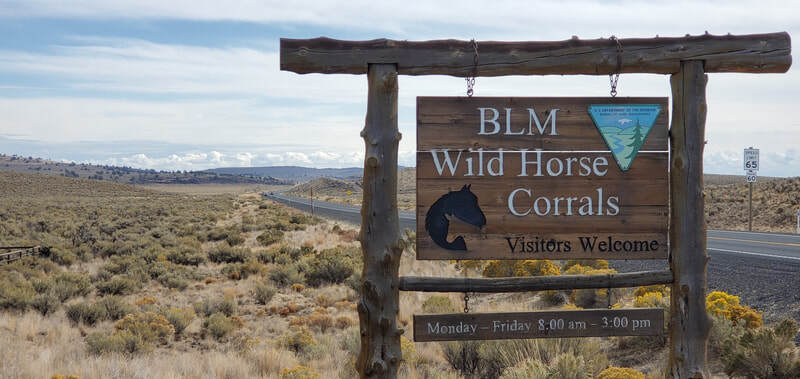
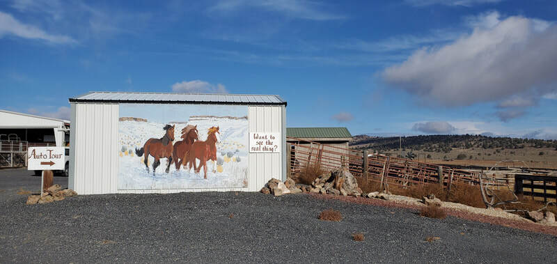
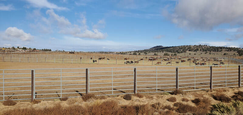
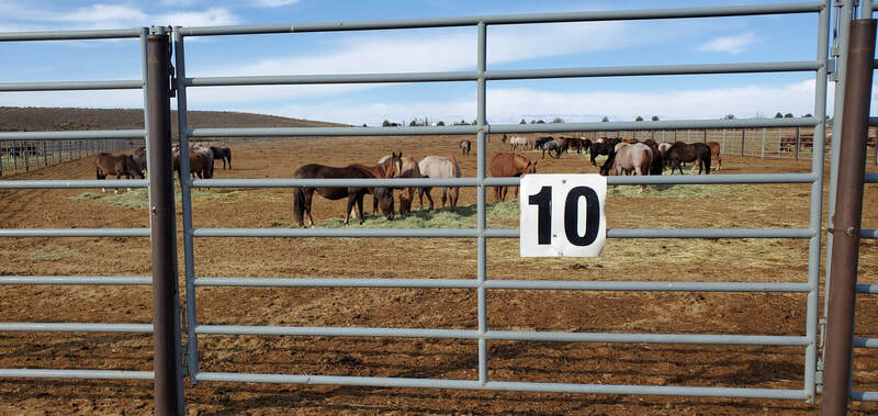
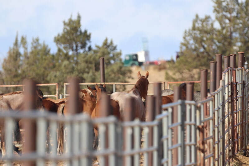
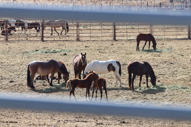
This is a drive-thru facility; you don't need to stop at the office or let anyone know you are there. You can stop near the corrals along the dirt road and get out of your vehicle to see the horses more closely. Don't expect any to come up to you, they are wild after all and most have just been through the traumatic experience of being rounded up and separated from their family bands. Others have been in the facility for months but are still scared of their surroundings. The ropes and tags you see around their necks are the BLM ID tags.
Size: 271,667 acres
Number of wild horses the BLM deems appropriate for the herd area is 60-150
Or you can enter near the town of Paisley of Hwy 31 and turn north on Red House Ln and stay left at the fork to stay on Road 6124; this will eventually join up with XL Ranch Rd and you will want to turn left to head north. It looks like XL Ranch Rd eventually dead ends up near Sand Canyon past Sheep Rock on the east. There seems to be multiple two-track roads you can take. Watch for recently used horse trails, water ponds, and manure piles to tell you if wild horses are in the area.
I highly recommend a high clearance vehicle.
Size: 71,000 acres
Number of wild horses the BLM deems appropriate for the herd area is 32-64
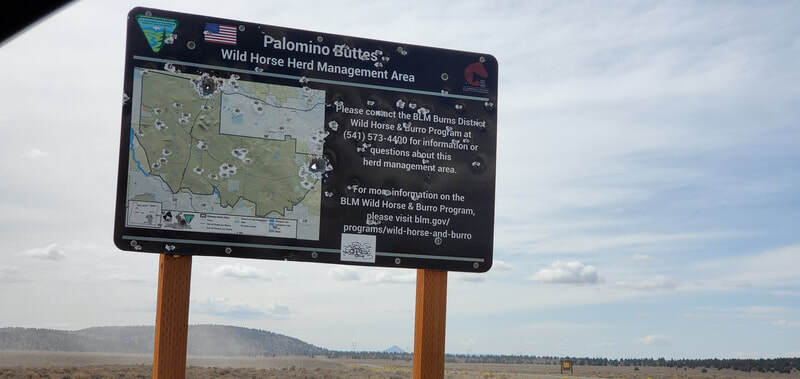
The Palomino Buttes HMA is easy to find, though last time I drove by in early 2022 the HMA sign had been taken down (see upper left photo). The herd area is approximately 12 miles west of the town of Hines on Hwy 20; you'll turn south onto Double O Rd and go over a cattle guard. If you reach or pass the rest area on Hwy 20 (west of the herd area) then you've gone too far but it's possible to spot wild horses from Hwy 20 until you reach Highway 395.
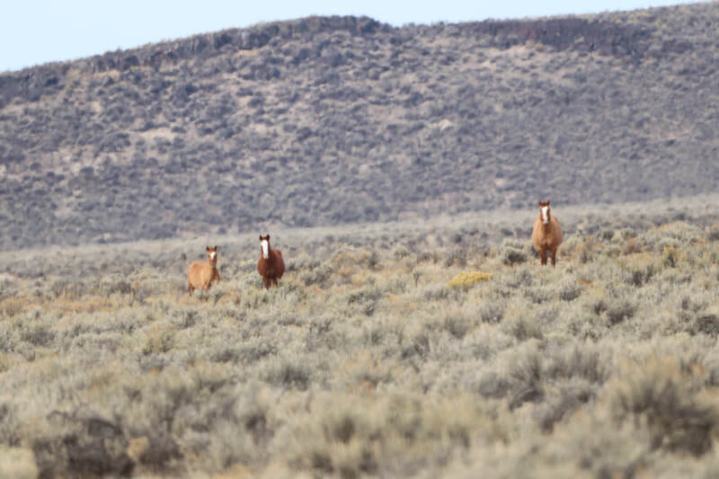
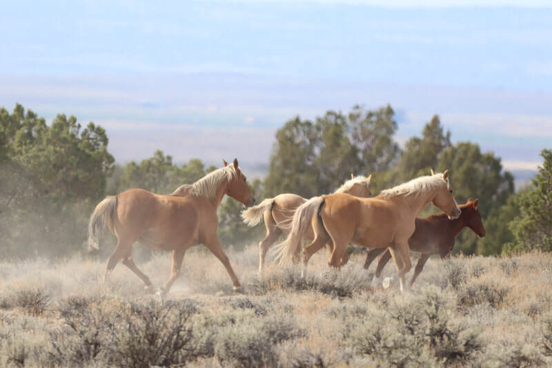
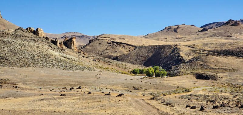
Double O Road is wide and well graveled, suitable for all vehicles as it is used by ranches in the area. You will quickly pass a waterhole on the right and you can start looking for wild horses right away. When I had visited in Fall of 2021, the herd had just been rounded up a couple weeks earlier and the small band of 3 and the larger band of 7 in the photos above were very skittish and ran away after seeing me. I had spotted the band of 3 off Double O Rd and the band of 7 by taking two tracks to the west off Double O Rd under the power lines.
There are several small dirt and two track roads that lead off from Double O Rd; I found the roads to the east to be very dusty and overgrown. The roads to the west were full of rocks and holes and made for a rough ride. For any of those 'roads' I suggest a high clearance vehicle with really good tires. If you stay on Double O Rd heading south, as soon as you come to the ranches I believe the herd area ends. Most of the herd area is to the east and west of the Double O Rd before the ranches.
UPDATE: I visited this HMA twice in April 2026 and did not find any wild horses or signs of wild horses (manure or tracks). My guess is there are few if any wild horses remaining in this HMA. I would suggest exploring two tracks to the east off Double O Rd.
Size: 80,885 acres
Number of wild horses the BLM deems appropriate for the herd area is 30-50
The herd can be found on any available forest roads south of Hwy 66 between Jenny Creek near the town of Pinehurst (the western boundary of the HMA) and the Klamath River is the east and southern boundary. This area is very close to the CA border so some of the forest roads may take you into CA and you may find wild horses there. This is a forest so look for meadows and clearings to hopefully spot horses; watch for actively used horse trails and fresh manure piles.
Size: 28,000 acres
Number of wild horses the BLM deems appropriate for the herd area is 33-56
The Riddle Mountain HMA is just east of the Kiger HMA though I don't believe they actually border each other. The BLM will occasionally move horses between the two HMA's for genetic diversity, yet they keep them both at very low herd numbers.
To reach the Riddle Mountain herd area, take Hwy 78 south out of Burns. It looks like you could turn right (south) onto Virginia Valley Road and head south into the herd area; it may be 10 miles or so before you see signs of wild horses. If you continue south you would eventually bump into East Steens Rd/Folly Farm Rd/Fields Denio Rd, turn left (east-northeast) to get back to Hwy 78 and turn north to return to Burns.
Alternatively, you might be able to get to the herd area by heading south on Hwy 78 out of Burns and continuing to East Steens Rd/Folly Farm Rd/Fields Denio Rd and turn right (west-southwest). Go past 16.5 miles, past Ten Cent Lake (which might be dry) and then Juniper Lake, and turn right (north) onto Stonehouse Rd. There may be a cattle guard and/or gate, unless it's marked Private Property or No Trespassing or locked, you should be allowed to go through. It looks like a rarely used two-track road that follows Stonehouse Creek. At the Y in the road or at any possible turns, stay right (east - north east). I see a couple water holes and what looks like horse trails leading from them. I'm told the roads are rough and often unpassable.
Size: 192,524 acres
Number of wild horses the BLM deems appropriate for the herd area is 100-200
There appear to be three entrances to the herd area: off Hwy 78 you can take Iron Mountain Rd north of Burns Junction (Iron Mountain Rd has two entrances and leads into the Saddle Butte Lava Field), and off Hwy 95 east of Burns Junction you can turn north onto Kiger Rd just east of the Crooked Creek Picnic Area (if you cross the Owyhee River to the east you've gone too far).
Iron Mountain Rd turns south and runs into Kiger Rd; turn north/left at the Y junction and head north to look for horses. This road appears to end and turn into a much smaller road near Chanis Rock and Wrangler Butte. You can explore two-track roads looking for signs of horses. Just remember to leave the HMA you need to go east to Hwy 78 or south to Hwy 95.
Size: 200,000 acres
Number of wild horses the BLM deems appropriate for the herd area is 161-302
The other way to enter the herd area is from Hwy 95 south of Burns Junction; go south of the 78/95 junction approx 6.1 miles and turn west onto Tudor Rd/Road 6314-1 (there may or may not be a locked gate here). Continue west and north to stay in the herd area; if you head south you will be in the Coyote Lake herd area. The Sheepshead Mountains will be to the west and Palomino Hills will be to the east. There are not many main roads in the area but several smaller two-track roads. Watch for recently used horse trails and fresh manure piles to know if you are in the right area. These horses do not see people often and will likely be skittish.
This herd area encompasses the Sheepshead Mountains so I would highly recommend a high clearance / 4WD vehicle with good tires.
Size: 130,000 acres
Number of wild horses the BLM deems appropriate for the herd area is 159-304
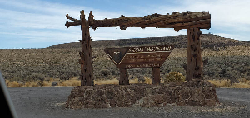
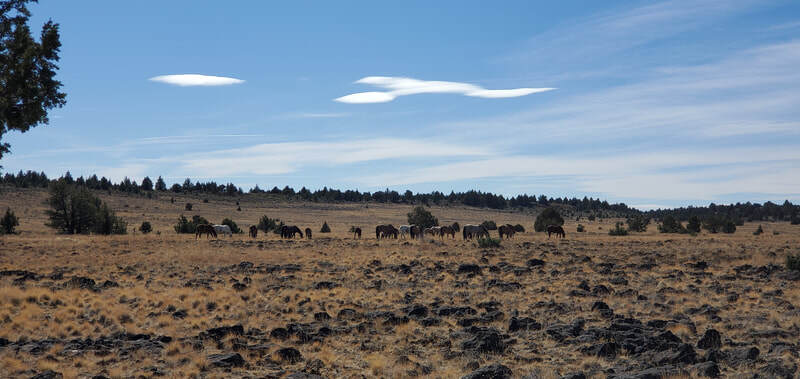
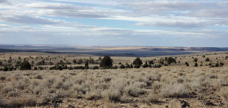
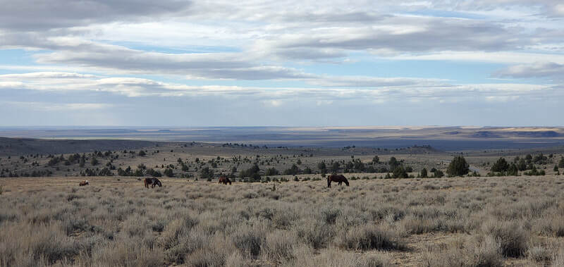
The Steens HMA is easy to get to, albeit after a long drive, and the main gravel road throughout the Steens Mountain Loop is suitable for all vehicles. To reach the herd area, take Highway 205 south out of Burns, OR towards the tiny town of Frenchglen 60 miles south. The northern end of the Steens Mountain loop begins just east of Frenchglen but to get to the herd area much faster you should continue south on Highway 205 another 10 miles to the Steens Mountain Loop Rd and turn left (east). You will see the Steens Mountain sign in the top left photo and soon after cross a cattle guard, then you can immediately begin to look for wild horses.
Several miles in there will be another cattle guard and fence line, I believe just before the bigger creek goes under the road, and that is where the herd area ends. If you get to the campground you are definitely outside the herd area. In early spring or when snow is expected, the gates might be closed just 3 miles into the HMA to prevent road damage.
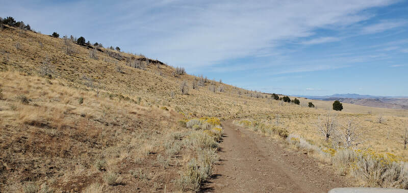
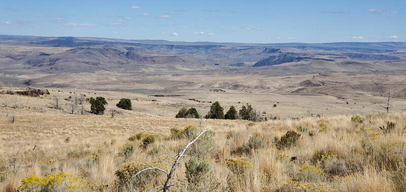
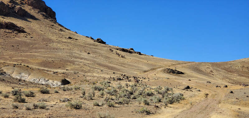
There are some smaller roads that go both right and left off of Steens Mountain Loop but you will need a high clearance vehicle with good tires to take most of them. When I went there were plenty of bands of horses to see along the main road; by taking smaller roads to the left/north I did see several bands of horses but none by taking roads to the right/south. These roads were bumpy with potholes and larger rocks. The herd was subject to a large roundup in summer of 2022 and another devastating roundup in 2024, so horses will be more difficult to find but you should certainly be able to see some. You are welcome to park off the road and hike to get closer to horses in hills but wear good hiking shoes or boots. The terrain is filled with volcanic rock and you'll need to watch for rattlesnakes.
The Steens Mountain Loop Road in itself is a gorgeous drive; once done viewing the herd area you could continue east, up the side of the mountain (the road does get narrow alongside a cliff at one point, just take it slow), up onto the plateau, then the road turns north and back west and eventually takes you into Frenchglen where you can get back on Highway 205.
Size: 78,000 acres
Number of wild horses the BLM deems appropriate for the herd area is 40-80
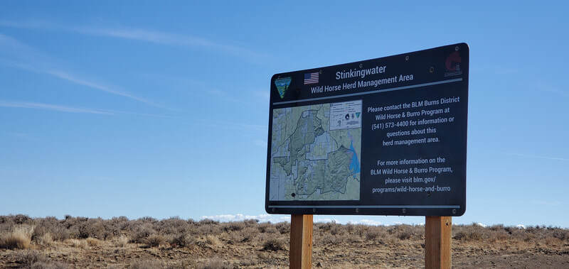
The Stinkingwater HMA is east of Burns, OR. Take Highway 20 26.7 miles past the Hwy 395 junction and watch for a dirt road on the right on Stinkingwater Pass just after a gravel pullout on the side of the road. You should see the herd area sign (see upper left photo) as you turn on the road and cross over a cattle guard. The off-road map lists this as Stinkingwater Access Rd and Google Maps lists it as BLM Access Rd. Alternatively, you could continue on Hwy 20 and turn right on Warm Springs Rd which is 10 miles past Stinkingwater Access Rd. Either road does a loop by connecting with Coleman Mountain Rd. I recommend a high clearance vehicle with good tires for this herd area.
This herd area is forested on the west side then opens up into valley in the middle and eastern side. I saw no horses during my first visit in 2021 but the herd was rounded up just a few weeks before I was there. The only places I saw signs of horses in the form of dry manure piles was on the eastern side on the roads along the hillsides and valleys. The area is fenced and cross-fenced and you will cross several cattle guards. I did not search south of Coleman Mountain Rd but rather focused on the northern section of the herd area.
UPDATE: I visited this HMA again in April 2026 and found a beautiful small herd of about 25 wild horses right off of Stinkingwater Pass Rd about 2-3 miles in.
Size: 62,509 acres
Number of wild horses the BLM deems appropriate for the herd area is 75-150
Now to find horses: after you leave the Succor Creek State Natural Area you can turn right/north onto McIntyre Springs Rd. That will head north past Three Fingers Rock. When you get to a main junction you can stay straight to be on Camp Kettle Creek Rd which will take you back out to Succor Creek Rd, or turn left to stay on McIntyre Springs Rd which eventually turns into Fisherman Rd near Board Corral Mtn. Fisherman Creek Rd will also eventually loop around to the east and take you back to Succor Creek Rd where you can return to Homedale.
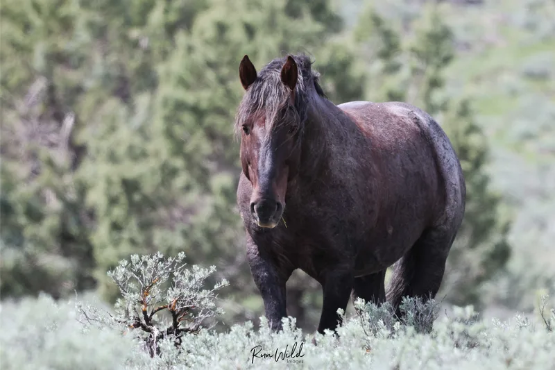
The Three Fingers HMA area is filled with hills and valleys, and it's gorgeous. I saw just the one band of 5 wild horses as I was leaving for the day. You will definitely need a high clearance vehicle with good tires; there are several places with big rocks in the road and potholes. I find it hard to believe there might be 150 wild horses in the herd area; the BLM removed the entire north herd a few years back after a wildfire and even though they were supposed to return the horses removed, they never did. While the wild horses do roam the range, you may have better luck finding some in the southern end.
There a couple roads that turn north off of Leslie Gulch Rd before it reaches the canyon area and I can see a few springs in the area with horse/cattle/wildlife trails leading in and out.
Size: 475,460 acres
Number of wild horses and burros the BLM deems appropriate for the herd area is 111-202
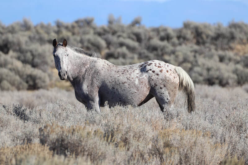
I searched north of Foster Flat Rd for a whole day and only found one wild horse, the beautiful appy in the above right photo. I saw no other signs of horses, no fresh manure piles. Some of the roads north of Foster Flat Rd are very sandy and others are filled with big rocks and potholes. I would recommend looking south of Foster Flat Rd in the Kegs Springs Valley or Tucke Flat. Foster Flat Rd continues east for quite a ways; take two track roads south to explore, then continue on Foster Flat Rd until it junctions. The herd area continues west a ways but you should refer to a map to continue.
You can also enter the herd area Hwy 395 south of the Christmas Valley junction. Travel south of the small airport to the Alkali Buttes and turn east onto Big Juniper Rd/Bacon Camp Rd. You will go past Gray's Butte then the road will junction; if you continue straight you will remain on Bacon Camp Rd which heads southwest but may be south of the herd area. If, at the junction, you turn left/north on Little Juniper Rd/Rd 6130 it will go up and run into Dry Valley Rd. You could turn east and explore the Dry Valley but you may run into some fenced off State Land.
Just north of the Hwy 395/Christmas Valley junction you can also access Dry Valley Rd / Rd 6110 and head east to explore.
The Warm Spring HMA is huge at nearly 500,000 acres and it wouldn't be possible to explore it all in one day. This might be a good camping experience if you have a few days. Be careful taking some of the smaller roads and don't trust the GPS in your vehicle; it led me wrong several times. Take good notes of your turns and if you do get lost remember that heading east will take you to Hwy 205, heading west will take you to Hwy 395. Don't travel south for too long; though if you do it will take you to the Warner Valley, Rabbit Basin, Warner Wetlands Area, and the Hart Mountain National Antelope Refuge. It would be a good idea to have an extra container of gas with you when exploring this HMA, just in case.
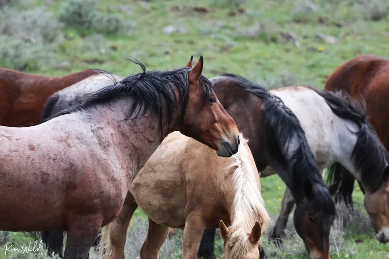
There are both wild horses and wild burros in this HMA so keep your eyes peeled for both!